Innovation and Research
Agriculture stands at a pivotal crossroads where centuries-old traditions meet cutting-edge technology. Modern farmers face unprecedented challenges—from increasingly unpredictable climate patterns to growing pressure for sustainable production—that traditional intuition alone cannot solve. The integration of sensors, automation, and data analytics into farming operations is no longer a futuristic concept but a practical necessity for those seeking to maximize efficiency while managing risk.
This transformation extends far beyond simply purchasing expensive equipment. True agricultural innovation requires understanding how different technologies interconnect—from moisture sensors that protect harvest quality to aerial imagery that reveals hidden crop stress, from smart irrigation systems that conserve water to analytics platforms that turn raw numbers into actionable decisions. This article provides a comprehensive foundation for understanding these innovations, exploring both the practical applications and the critical considerations that separate successful implementation from costly missteps.
The Transition to Data-Driven Agronomy
The shift from experience-based farming to data-informed decision-making represents one of the most significant changes in agricultural history. Traditional farming wisdom—built on observation, seasonal patterns, and generational knowledge—served farmers well for centuries. However, modern climate unpredictability has fundamentally altered the reliability of these historical patterns. When rainfall no longer follows expected cycles and temperature extremes become routine, past experience becomes a less reliable predictor of future outcomes.
Starting the digitalization journey doesn’t require a complete farm overhaul. The most successful transitions begin with identifying specific pain points—a field with inconsistent yields, irrigation zones with unexplained water waste, or harvest timing decisions that feel like educated guesses. Think of digitalization as adding instruments to a cockpit: a pilot doesn’t need every gauge at once, but rather the critical ones that address the most dangerous blind spots first.
The comparison between manual record-keeping and automated systems reveals telling differences. Manual logs demand discipline and time, often becoming incomplete during busy seasons when data would be most valuable. Automated systems capture information continuously, but their real advantage lies in making connections humans might miss—correlating weather conditions with pest outbreaks, or linking soil moisture patterns to yield variations across multiple seasons.
A common pitfall is the technology cost trap. Expensive, feature-rich systems often include capabilities that a specific operation will never use. A mid-sized grain operation doesn’t need the same level of variable-rate precision as a high-value vegetable producer. Retrofit sensors that add intelligence to existing machinery often provide better return on investment than completely new equipment, transforming a functional combine or pivot into a data-generating asset without the depreciation hit of replacement.
Precision Moisture Management for Grain
Few decisions impact profitability as directly as harvest timing based on grain moisture. Harvesting too wet means paying for expensive artificial drying and risking quality degradation during storage. Harvesting too dry leads to field losses from shattering and lower overall yield. The margin between these extremes can be surprisingly narrow—sometimes just a few percentage points of moisture content—making accurate measurement critical.
Combine-mounted moisture sensors provide real-time feedback, but their accuracy depends heavily on proper calibration. Different crop varieties, changing field conditions, and even the time of day can affect readings. The most reliable approach involves calibrating sensors against laboratory-tested samples from your specific fields at the beginning of each harvest season, then spot-checking throughout to catch any drift in accuracy.
The choice between capacitance and NIR (near-infrared) meters involves tradeoffs. Capacitance meters are more affordable and robust but can be affected by grain temperature and require crop-specific calibration. NIR technology offers faster, non-contact measurement across different grain types but comes at a higher price point. For operations handling multiple crops, NIR’s versatility often justifies the investment.
Storage presents its own moisture challenges. Large silos create conditions for moisture migration—warm, moist air rises and condenses on cooler grain near the top, creating pockets of high moisture that become breeding grounds for mold and insects. Proper aeration management and monitoring systems that track temperature and moisture at multiple silo depths turn storage from a passive waiting period into an active quality preservation process. Optimizing dryer settings represents another opportunity: many operations run dryers hotter than necessary, burning extra fuel while potentially damaging grain quality, when lower temperatures with longer residence times would achieve the same moisture reduction more efficiently.
Smart Irrigation Technologies
Water application based on timers or fixed schedules wastes one of farming’s most precious resources. Smart irrigation systems that integrate sensors and automation represent a fundamental improvement in water management, but their effectiveness depends on using the right decision-making models.
Evapotranspiration (ET) models outperform simple timers because they account for the actual water lost to both evaporation and plant transpiration. These models combine weather data—temperature, humidity, wind speed, and solar radiation—with crop-specific coefficients to calculate daily water needs. The difference between a timer that applies water every three days regardless of conditions and an ET-based system that adjusts for a cool, cloudy week can mean thousands of gallons saved and healthier crops that aren’t overwatered during low-demand periods.
Modern telemetry systems enable remote valve control, allowing farmers to start, stop, and adjust irrigation from a smartphone rather than driving to distant fields. This convenience translates to real operational advantages: responding immediately to unexpected rainfall, adjusting schedules around weather forecasts, and managing irrigation during evening hours when evaporation rates are lower without being physically present.
The efficiency comparison between drip tape and center pivot systems depends heavily on crop type and field characteristics. Drip irrigation can achieve 90-95% efficiency by delivering water directly to root zones with minimal evaporation, making it ideal for high-value row crops and irregular field shapes. Center pivots, typically 75-85% efficient, offer lower per-acre installation costs and less labor for maintenance, favoring large, uniform fields growing grains or forage. Neither system is universally superior—the choice depends on matching technology to specific operational needs.
Water quality issues, particularly salinity buildup, can undermine even the most sophisticated irrigation system. Poor-quality water applied efficiently is still poor-quality water, and over time, salts accumulate in the root zone, damaging crops. Regular water testing, periodic leaching events, and in some cases, switching to more salt-tolerant varieties become necessary management strategies. Variable rate irrigation (VRI) on pivots takes this further, adjusting water application across the field based on soil type, elevation, and crop needs—applying more water to sandy spots that drain quickly while reducing application on heavier soils that retain moisture longer.
Aerial Crop Monitoring and Spectral Imagery
What the human eye cannot see, aerial sensors can reveal. Spectral imagery captures light reflectance across multiple wavelengths, translating invisible patterns of crop stress into actionable field maps that guide targeted interventions.
The Normalized Difference Vegetation Index (NDVI) remains the most widely used vegetation indicator, measuring the difference between red and near-infrared light reflectance to assess plant health and biomass. However, NDVI has a critical limitation: it saturates in high-biomass crops. Once plants reach full canopy closure with dense, healthy vegetation, NDVI maxes out and can no longer distinguish subtle differences. This is why monitoring programs often incorporate additional indices like NDRE (Normalized Difference Red Edge) or use multi-temporal comparisons to track changes over time rather than relying on single snapshots.
Creating accurate field maps requires stitching together dozens or hundreds of individual images. This process demands consistent lighting conditions and precise GPS coordination. Flight planning software helps, but successful stitching also depends on adequate image overlap—typically 70-80%—and stable camera positioning. Poor stitching creates artifacts and false anomalies that can lead to misguided management decisions.
The choice between fixed-wing drones and quadcopters for large acreage operations involves fundamental tradeoffs. Fixed-wing platforms fly faster and longer, covering thousands of acres on a single battery, making them efficient for broad surveillance of large, contiguous fields. Quadcopters offer superior maneuverability, hovering capability for detailed inspection, and easier pilot certification requirements, but their limited flight time restricts them to smaller areas or spot-checking specific zones identified by other means.
Technical considerations can make or break imagery quality. Sun angle affects shadows and reflectance values—midday flights with the sun directly overhead minimize shadows but may create hotspots in imagery. Early morning or late afternoon provides softer light but longer shadows that can obscure features. Flight altitude represents another balancing act: flying lower increases image resolution and detail but reduces coverage area and increases the number of images requiring stitching, while higher altitudes sacrifice detail for efficiency and longer battery life.
Farm Data Analytics and Predictive Insights
Collecting data is only the beginning. The real value emerges when raw numbers transform into insights that change decisions—predicting nitrogen needs before deficiency appears, identifying yield-limiting factors across fields, or forecasting optimal harvest windows days in advance.
Data standardization is the unglamorous but essential first step. Information arrives from multiple sources—yield monitors recording bushels per acre, soil tests reporting nutrient levels in parts per million, weather stations tracking rainfall in inches, and satellite imagery providing reflectance values in arbitrary units. Before any meaningful analysis can occur, these disparate data streams must be aligned geospatially, synchronized temporally, and converted to compatible formats. Without this foundation, analytics efforts produce unreliable results or fail entirely.
The power of correlating yield maps with soil tests illustrates how combining data sources reveals insights neither provides alone. A yield map might show a low-producing zone, but without soil data, the cause remains speculative. When soil tests reveal low phosphorus levels precisely where yields drop, the connection becomes clear and the solution targeted. Multi-year analysis strengthens these correlations further, separating temporary weather effects from persistent soil limitations that justify long-term amendments.
The decision between cloud platforms and desktop software for analytics involves more than just preference. Cloud-based solutions offer accessibility from any device, automatic updates, and collaboration features that let agronomists or consultants access the same data remotely. Desktop software provides offline capability, potentially faster processing of large datasets, and data control that some operations prefer for privacy. Many successful operations adopt a hybrid approach: using cloud platforms for field data collection and sharing while maintaining desktop tools for deep analysis and long-term records.
Data outliers—the suspiciously high yield reading from a combine passing through a calibration area, the erroneous soil test from a contaminated sample, the weather station recording phantom rainfall from sprinkler overspray—can distort analysis severely if not addressed. Rather than automatically deleting outliers, the best practice involves investigating their cause. Some outliers represent genuine extreme values worth understanding, while others are measurement errors that should be corrected or removed. The danger lies in ignoring them entirely, allowing bad data points to skew averages, correlations, and ultimately, management decisions.
Nitrogen modeling that incorporates weather data demonstrates predictive analytics at its most practical. By combining soil nitrogen levels, crop growth stage, and upcoming weather forecasts—particularly rainfall that might cause leaching or hot, dry periods that increase mineralization—these models project when crops will need supplemental nitrogen and how much. This predictive capability allows splitting applications to match crop demand more precisely, reducing over-application that wastes money and creates environmental concerns while preventing under-application that limits yield potential.
Agricultural innovation continues accelerating, but successful adoption requires moving beyond technology for its own sake. The most valuable innovations solve specific problems, integrate with existing operations, and generate returns that justify their complexity. Whether implementing the first digital tools on a traditional farm or optimizing an already technology-rich operation, the path forward combines careful evaluation, strategic implementation, and continuous learning from the data these systems generate.

From Raw Data to Predictive Power: A Guide to Forecasting Your Farm’s Input Needs
Forecasting next year’s inputs isn’t a guessing game; it’s a science that hinges on treating your farm data with methodological discipline. Effective prediction begins with rigorous “data hygiene”—standardizing and cleaning historical information to remove errors and inconsistencies. Moving beyond simple…
Read more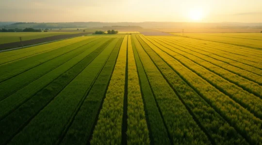
How to Interpret Multispectral Drone Imagery for Nitrogen Application?
Misreading a multispectral map is a costly mistake. The colors aren’t a simple instruction manual; they’re data points whose meaning changes dramatically with crop stage, time of day, and the specific index used. True precision comes not from the drone…
Read more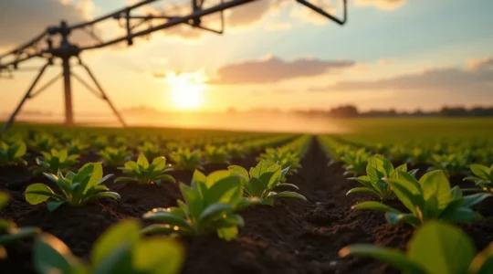
Cut Water Use by 20%: The Engineer’s Guide to Soil Moisture Sensors
In summary: True water savings come from creating a data-driven ecosystem, not just using a sensor. Automating irrigation based on real-time soil data—not timers or forecasts—is the key to precision. Sensor data can be used as a powerful diagnostic tool…
Read more
Beyond the Reading: How Grain Moisture Meters Prevent Costly Storage Spoilage
The common belief is that simply owning a moisture meter prevents spoilage; the reality is that profit is lost in a chain of uncalibrated sensors, unseen measurement errors, and flawed storage protocols. Inaccurate combine sensors and portable testers can create…
Read more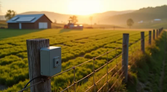
How Data-Driven Agronomy Increases ROI for Mid-Sized Farms
The key to unlocking higher ROI isn’t replacing your farming experience with expensive tech, but amplifying it with targeted, actionable data. Start your digital transition with a single, high-impact metric (like fuel consumption per acre) to prove value before expanding…
Read more